EXCERPT
1. Learning About Our Rivers
The State of the River Report is a comprehensive presentation of water quality data collected by the Roaring Fork Conservancy’s water quality monitoring program for the year 2000. The data is displayed in both temporal and spatial formats, and is available to local governments, land management agencies, interested community members, and other groups. The information can be used for decision-making processes related to our rivers’ water quality as well as to increase knowledge and awareness about the relationship between water quality and the health of our rivers. Water quality data is illustrated within this report relative to State-adopted stream standards and biological thresholds. Comparisons of data with State standards can help determine a desired level of overall stream health. Finally, the baseline of water quality information provided here represents an effective tool for observing trends over time and space.
2. How to Use this Report
The heart of this report can be found in Section 10, which contains water quality data by parameter, sampling location, and sampling month for the year 2000. The sections that lead to the specific data descriptions provide historic information about the watershed, availability of historic data, description of water quality sampling sites, and the methodology that the Roaring Fork Conservancy (Conservancy) has implemented within its water quality monitoring program. Finally, through interpretation of the baseline data, findings and conclusions are presented about the water quality of the Roaring Fork River.
With this report, both in its written form and through public presentations of its results, the Conservancy is providing the raw data and the baseline information for future comparisons of data. Initial interpretation regarding trends and ecosystem health begins with this data set. Others are strongly encouraged to review and use this data, whether it is for site-specific analysis, for more general research, to inform public debate on water quality issues, for educational purposes, or for other reasons. The Conservancy plans to present this report at various public meetings throughout the watershed in an effort to inform a broader constituency about the Valley’s water quality status and issues.
3. The Roaring Fork Watershed
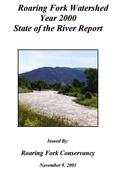
The Roaring Fork watershed, shown in Figure 1, is the network of streams and rivers, including the areas they drain that ultimately feed into the Roaring Fork River. The Roaring Fork River’s mainstem flows for approximately 70 river miles, starting at an elevation of over 12,000 feet at its headwaters near Independence Pass and the Continental Divide. The river drops over 6,000 feet to its confluence with the Colorado River at Glenwood Springs and during this journey transforms from a tumbling, fastflowing mountain stream to a wider, meandering river. The Ute Indians, who seasonally occupied the Roaring Fork Valley before white settlement, fully understood the wild, raging qualities of the Roaring Fork, calling it “Thunder River.” In terms of flow, the Roaring Fork River is the second largest tributary of the Colorado River in the state, and its watershed encompasses a total of 1,460 square miles. The major tributaries of the Roaring Fork River are the Fryingpan and Crystal Rivers. All of the Valley’s major communities, including Aspen, Basalt, Carbondale, and Glenwood Springs, are located along the Roaring Fork or its main tributaries (Figure 1).
The Valley itself has witnessed a diversity of human settlement trends and associated land uses. These include habitation of the area by Ute Indians, an intense but short-lived gold and silver mining rush, agricultural activities, and the advent of what has become a major tourist industry: ski area development. The current trend in the Valley is that of increased population growth, given the area’s combination of outdoor recreational opportunities, rural lifestyle, and availability of urban and related cultural amenities.
Annual mean snowfall in the watershed is 65 to 70 inches and annual mean rainfall is 11 inches. Lava beds, the Maroon Formation, the Eagle Valley Gypsum Formation, Mancos Shale, and Mesa-Verde Sandstone occur along the lower valley. Above Aspen, granite, gneiss and schist rock formations are dominant. Plant communities along the river include canopy species of ponderosa pine, narrow leaf cottonwood, box elder, and juniper; and under story species of water birch, Gamble’s oak, wild rose, coyote willow, and scouler willow. Fish species found in the watershed include brook, brown, rainbow and Colorado River cutthroat trout, and mountain whitefish. Caddisflies, stoneflies, mayflies and midges represent common macroinvertebrates (aquatic insects) found along the Valley’s rivers (Colorado Natural Heritage Program, 1997).
4. A Taste of the Basin’s Water Quality
Water quality and quantity in the watershed influence water uses, recreational pursuits (including: angling, kayaking, and rafting), and wildlife habitat dependent on flowing streams within the Valley’s river corridors. As land uses have changed, so have water quality issues – with a historic focus on heavy metals from mining entering streams, and runoff from agricultural practices. Presently, attention has shifted to the influence of development pressures on our streams and rivers, through wastewater treatment discharges, storm water runoff, and increased erosion and sediment-loading.
The mainstem of the Roaring Fork River, as well as all tributaries from the source to the confluence with the Colorado River are categorized as Roaring Fork Basin, segments 1 through 10, by the State of Colorado. The State Water Quality Control Commission (WQCC) has classified the Roaring Fork River as follows: Aquatic Life Coldwater – Class 1, Recreation – Class 1, water supply, and agriculture. Section 8 provides more detailed discussion of the significance of these classifications (CDPHE, 1999).
The water quality in the Upper Colorado River Basin, which includes the Roaring Fork watershed, has been reported as some of the best in the State (CDPHE, 1998). Stretches of the Roaring Fork River and Fryingpan River are classified as "Gold Medal" waters by the Colorado Division of Wildlife (CDOW), signifying the excellent quality of the rivers’ fisheries. Part of the Upper Roaring Fork River is designated “Wild Trout” water, which means this part of the river contains a self-sustaining trout population. This is one of the few such populations remaining in Colorado. However, the river system is facing strong land development pressures, the effects of which include construction and use of transportation corridors and bridges, filling of the river channel and floodplain, degradation and removal of natural vegetation, increased recreational use (rafting and angling), facility development (golf courses), and increased residential and commercial uses along the river.
As an example of the impacts of development on water quality, water quality standards were lowered for ammonia discharges on Landis Creek in Spring Valley, southeast of Glenwood Springs. Significant development was proposed and subsequently approved, but the flow in Landis Creek is small and applicable ammonia standards for the wastewater discharge were very difficult to meet under the previous standard. The State classification was changed from Cold Water Aquatic Life Class 1 to Class 2, with an associated change in un-ionized ammonia standard from 0.02 milligrams per liter (mg/L) to 0.1 mg/L. While this standard change would not be appropriate for the Roaring Fork and key tributaries where there is an established cold-water fishery, this issue demonstrates that development will affect high quality stream standards.
In addition, there is a question about the impacts to water quality of non-point source pollution introduced into the Roaring Fork River and its tributaries mainly through storm water runoff. Such pollutants may include suspended sediments, bacteria, nitrogen compounds (ammonia, nitrates, nitrites), magnesium chloride and other deicers, phosphorus, and dissolved metals. Other potential threats to the quality of the water in the watershed may come from individualized septic systems and the dewatering of streams from snowmaking practices by ski areas.